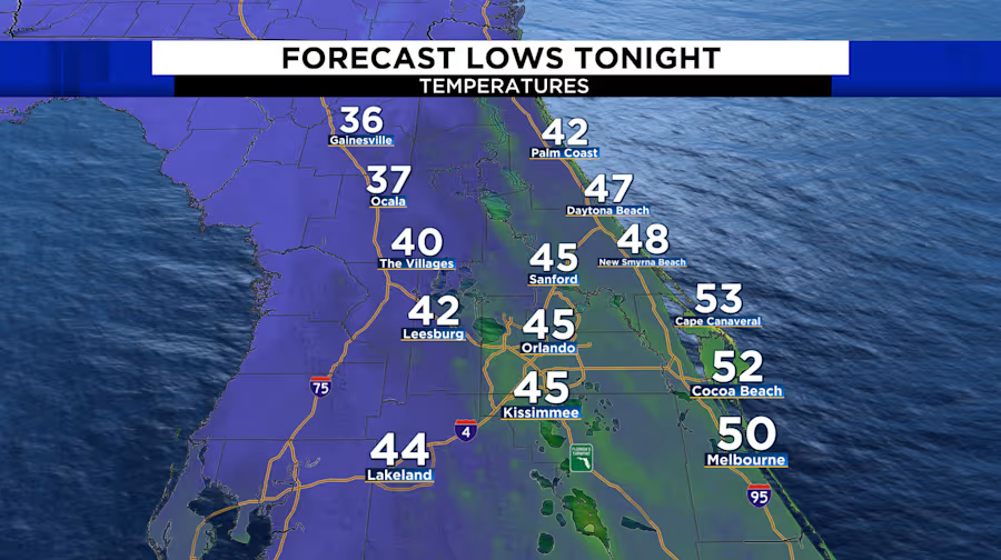
ORLANDO, Fla. – After a cool day in Central Florida, with temperatures only reaching the low 60s, another cold night is in store.
Clouds along the coast will help keep temperatures slightly warmer, ranging from the mid-to-upper 40s to low 50s.
West of I-95, mostly clear skies will allow temperatures to drop into the upper 30s to low and mid 40s. Across the region, wind chill values will range from the mid 30s to mid 40s overnight and into early tomorrow morning.
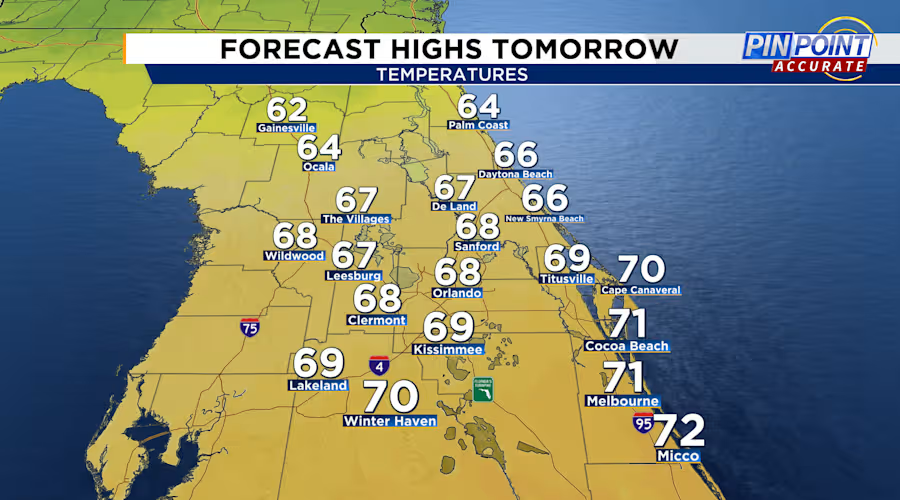
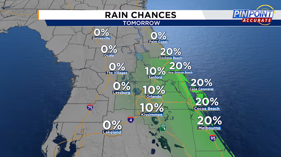
Winds will remain from the north-northeast at 10-15 mph tomorrow. A few clouds are expected throughout the day, with highs in the upper 60s to low 70s. Along the coast, expect a few showers to move onshore late in the afternoon and continue through the evening and overnight hours. Mainly light rain will fall, with occasional breaks. The entire evening won’t be a washout.
Winds will remain out of the north northeast 10-15 mph tomorrow. There will be a few clouds throughout the day with highs in the upper 60s to low 70s. Along the coast expect a few showers to move onshore late in the afternoon through the evening and overnight hours. Mainly light rain will fall with breaks at times. The entire evening won’t be a washout.
As we head into the upcoming week, the return of onshore flow will bring a gradual warm-up and occasional showers, along with the development of a trough of low pressure just offshore.
Rain chances will remain low, between 20-30%, through Christmas, with possibly an isolated shower through Friday. Highs will stay in the low-to-mid 70s through Christmas, rising to the upper 70s late in the week and into next weekend.

